Carbon County

County History
A Brief History of Carbon County
Most of Carbon County’s residents live in the Price River Valley and at the foot of the Book Cliffs. The western end of the county rises to the Wasatch Plateau and slopes down eastward to the Price River which cuts through Castle Valley. This valley stretches across the southern half of Carbon into Emery County, with the Wasatch Plateau on the north and west and the Book Cliffs all along the east. The Green River marks the eastern border of the county. Geographically, Carbon County is in the Colorado Plateau physiographic province.
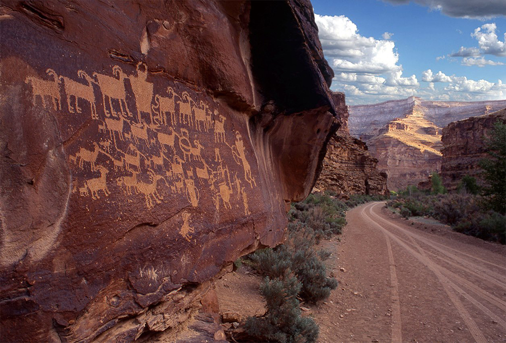
Evidence of the Fremont Culture is extensive in the county. Figurines have been discovered as well as many rock art panels, such as the “Head Hunter” located in the Gordon Creek area. Evidence of prehistoric life includes many dinosaur footprints found in coal mines.
Mormon settlements were established all along the Price River in the late 1870s. The high barrier of the Wasatch Plateau had delayed settlement until that time. Routes into the region included offshoots of the Old Spanish Trail and a trail over Soldier Summit. Farming and ranching became early economic activities, giving Carbon County a tradition of cowboys and outlaws, with the likes of Butch Cassidy and Gunplay Maxwell roaming the area. The Nine Mile Canyon freight road from Price to the Uinta Basin became an important transportation link. In 1894 the territorial legislature separated Carbon County from Emery County.
During the early 1880s the Denver and Rio Grande Western Railroad, seeking a route from Denver to Salt Lake City, discovered and opened up the vast coal lands of Carbon County. Coal mining became the major catalyst for development. Coal companies often built and ran towns in Carbon and imported many southern and eastern European and Japanese laborers to work in the coal mines and on railroad gangs. Helper became known as the town of “57 Varieties” because of its ethnic diversity. Mine explosions near Scofield in 1900 (200 killed) and at Castle Gate in 1924 (172 killed) and major strikes in 1903-4, 1922, and 1933 brought tragedy, violence, and eventual unionization to the mines. Coal mining continues to play a vital role in economic and social development, with ups and downs in the industry creating periods of boom and relative bust. Utah Power and Light built a main electric generating plant near the former town of Castle Gate. In 1980 the Carbon Plant generated 171 megawatts of electricity. Ninety-eight percent of UP&L’s power comes from thermal steam plants that burn coal.
The College of Eastern Utah [now Utah State University Eastern], established in 1937 in Price, promises to become a more important facet of the county’s economic and social development in the future.
Information
Founded
1894Origin of Name
The amount of coal found in the countyLocation
East-central region of the stateCounty Size
The size of Carbon County is 1,479 square miles.Current Population
The current population of Carbon County as of 2023 is 20,609U.S. Census Bureau, Population Estimates Program, V2023
County Website
https://www.carbon.utah.govBordering Counties
Cities & Towns
County Profile Links
4th Grade Reports
Higher Education
School Districts
Carbon County Image Gallery
Great Hunt Panel Rock Art, Nine Mile Canyon

